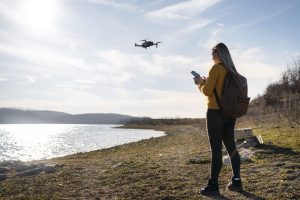
Drone photogrammetry has become an essential tool of application in modern cartography, allowing to obtain accurate measurement data and three-dimensional models thanks to the analysis of aerial photographs. In this article, we will explore what is drone photogrammetry, its benefits and the requirements needed to work in this innovative field. If you want to become a drone professional take a look at our courses:
What is photogrammetry with drones?
Photogrammetry is the technique of studying and accurately defining the shape, dimensions and position in space of any object, essentially using measurements made on one or more photographs of that object.
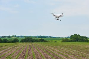
In the context of drone photogrammetry, aircraft equipped with high-resolution cameras and sensors are used to take photographs from various angles and heights. These images are then processed to generate accurate representations of the terrain or any object of interest.
There are four main phases in a photogrammetry project:
- Planning: Flight paths and ground control points needed to ensure complete coverage of the area of interest are planned.
- Capture: Drones perform the scheduled flights, taking aerial photographs from multiple angles, heights, overlapping, etc.
- Processing: Images are processed with photogrammetry software to create accurate models.
- Analysis: The generated model is analyzed to obtain accurate measurements and detect possible faults or defects, and its subsequent use.
This method is especially useful for creating orthophotos and point clouds that allow the terrain to be examined with an accuracy of up to 1 mm/pixel.
Benefits of photogrammetry with drones
The use of drones in photogrammetry offers multiple advantages and benefits compared to other methods such as traditional ones:
Significant reduction in labor time
Drones can complete the activity in much less time than how it is done by traditional methods. Accurate aerial triangulation, GPS reference coordinates and the use of specialized image processing software can greatly speed up projects.
Reduced operating costs
Drone photogrammetry reduces labor, transportation and equipment costs, making more effective use of financial resources without losing quality.
Remote and safe operation
Drones make it possible to work over large distances and areas, eliminating the need to physically traverse dangerous, difficult and rough terrain. This, apart from making the work safer and more efficient, contributes to reduce the risk of work accidents compared to those jobs where the human being must carry out the process physically.
Obtaining photographs
Drones capture high-resolution images from different heights and angles, obtaining precise details of the terrain and improving the control and quality of the final results.
Rapid deployment in a variety of environments
The flexibility and rapid deployment of drones allows them to be used in a wide variety of areas, including hard-to-reach areas. Their high movement capability increases the efficiency of photogrammetry work.
Positioning, Inspection and Intelligent Piloting Systems
The latest generation drones feature advanced technology such as high-precision GPS systems with RTK (Real Time Kinematic or Real Time Satellite Kinematic Navigation), automatic flights and improved systems, which increase the accuracy and efficiency of photogrammetric operations.
Ability to work in adverse conditions and with additional equipment
The drones can operate in various weather conditions and are compatible with the installation of additional equipment according to the needs of the project, expanding the possibilities of use and ensuring their adaptation to different jobs and environments.
Requirements to work in drone photogrammetry
To work in photogrammetry with drones, it is essential to have the appropriate knowledge and skills, in addition to having the Drone Pilot Course as a first premise and requirement:
- Technical training: It is necessary to know how to take photographs accurately, to plan aerial and ground projects, and to know the types of drones that can offer the best results.
- Adequate equipment: You must have a drone with adequate features, such as a high-resolution camera, long-lasting batteries and specific accessories such as thermal cameras or water resistance, depending on the work to be done.
At Grupo UAS we offer a specialization course in photogrammetry with drones that will allow you to plan projects of this type like a professional. Explore all the courses available at Grupo UAS to become a professional drone pilot and master this revolutionary technology. And if you are already a professional but need some extra help to make the leap into the world of photogrammetry contact us to schedule a personalized drone consulting session.